ADOT
Could ADOT’s Koli Road Concept Be the Game-Changer We Didn’t Expect?

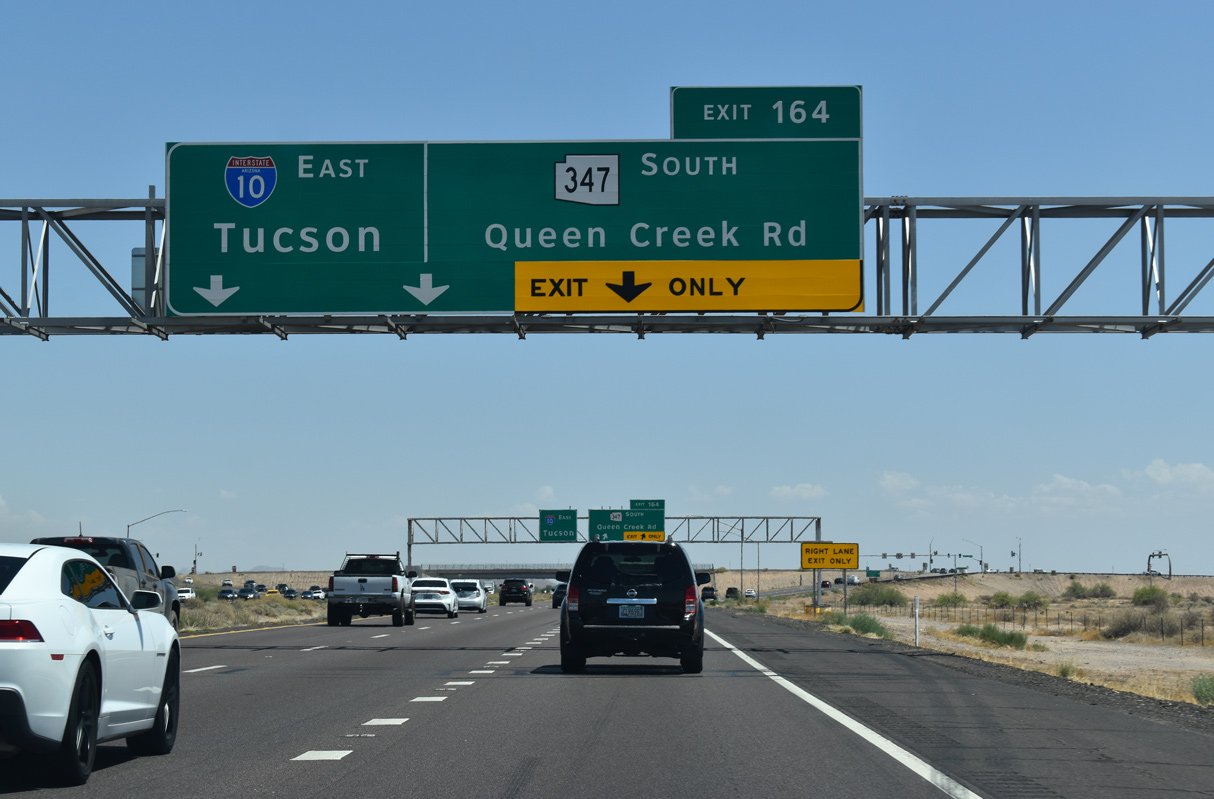
The Arizona Department of Transportation (ADOT) convened a public meeting last night to discuss the Interstate 10 and Koli Road Traffic Interchange Study. This initiative aims to address traffic congestion at the State Route 347 interchange while gathering input from local stakeholders.
The proposed interchange, initially named the Germann Road Traffic Interchange, will form part of the Wild Horse Pass Corridor Projects. It seeks to introduce a new interstate exit situated between the existing Wild Horse Pass Boulevard and State Route 347/Queen Creek Road exits.
Over the years, Wild Horse Pass Boulevard has served as a crucial detour for Maricopa commuters returning from the Valley to reach SR 347 via Maricopa Road. “The Gila River Indian Community is experiencing significant growth,” stated Carmelo Acevedo, ADOT project manager, during the meeting. This increased growth has led to limited direct access to the interstate, resulting in inefficient traffic routes. The upcoming project intends to enhance these connections, facilitating regional growth.
During the presentation, Acevedo emphasized that the Wild Horse Pass Corridor functions as a significant hub for tourism and transportation, underscoring the necessity for upgraded infrastructure. Current interchanges are ill-equipped to manage both existing traffic volumes and anticipated growth.
To address these issues, several alternatives for the interchange were presented:
The first option, termed the “no-build” option, would maintain existing infrastructure over the next two decades without establishing new interstate access or a connection between Koli Road and I-10.
The second option, a diamond interchange, would create a new arterial link, featuring four ramps connecting Koli Road to I-10 along with a bridge spanning 122 feet across the interstate.
The third alternative is a diverging diamond interchange, intended to improve traffic flow, particularly for left turns. This configuration will divert traffic to the left side of the roadway, creating two separate paths for eastbound and westbound traffic across I-10.
Both the diamond and diverging diamond interchanges aim to boost connectivity and reduce congestion, though Acevedo highlighted that the conventional diamond interchange is more familiar to drivers and pedestrians in the area. Arizona already hosts over 400 diamond interchanges compared to just six diverging diamonds.
Environmental considerations were also a key topic during the meeting. ADOT evaluated 15 criteria, including water resources and local community impacts. While the no-build option would pose the least environmental risk, both build alternatives demonstrated comparable impacts. The diamond interchange necessitates a 34-acre land acquisition, while the diverging option requires 36 acres, primarily from tribal land.
Financial backing for the project has been solidified, with the Maricopa Association of Governments allocating $77.6 million for right-of-way acquisition, utility relocation, and construction. This includes $55 million for construction efforts alone.
Next steps involve drafting an Environmental Assessment and Design Concept Report by spring, with public findings expected next summer. During last night’s meeting, the public posed questions regarding the services the new interchange would offer compared to existing ones and its potential effect on local venues, including the Firebird Motorsports Park.
Acevedo reiterated that the project’s benefits would extend to local road systems, aligning with regional development while ensuring access to key attractions. Individuals who missed the meeting can contribute feedback via email at KoliRoad@AZDOT.gov or by phone at 855-712-8530 until November 8, when comments will be compiled as part of the environmental study.


