Community
This Hidden National Monument Could Be Maricopa’s Best-Kept Secret!

Discovering the Hidden Gem of Sonoran Desert National Monument
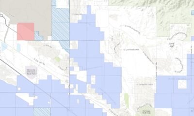
The Sonoran Desert National Monument, an expansive 500,000 acres situated in the 85139 ZIP code, remains one of Maricopa’s best-kept secrets. It features three federally protected wilderness regions and offers 26 miles of hiking trails through awe-inspiring desert landscapes.
Despite its grandeur, visitor interest seems limited. Dorothy Charles, an archivist at the monument’s visitor center in Maricopa, noted that inquiries about the area are infrequent. “We just get it now and then,” she remarked, emphasizing the need for local residents to embrace this natural wonder.
The Creation of the Monument
Establishing the monument was a significant event in 2001, when President Bill Clinton proclaimed it a national monument as one of his final acts in office. Nestled between the contrasting landscapes of cottonfields and saguaro cacti, it spans from south of Interstate 8 to the edges of the Gila River Indian Community.
Chris Wonderly, a public affairs specialist for the U.S. Bureau of Land Management (BLM), clarified the distinction between the monument and a national park. “It’s not a national park because it was established by presidential proclamation,” he explained, noting that only Congress can designate national parks.
Access and Activities
Maricopa residents can easily access the monument via State Route 238, just eight miles west of the city. Although less protected than national parks, the monument primarily accommodates hikers, cyclists, and horseback riders. Visitors can camp for free, but off-road vehicles are prohibited.
The monument boasts stunning vistas of the Maricopa, Sand Tank, and Table Top mountain ranges, along with the Booth and White hills. However, those planning to explore the Sand Tank Mountains will need a permit, available online after watching a brief safety video.
A Historical Pathway
Throughout history, early Indigenous peoples, Spanish explorers, and settlers traversed this land. The monument houses significant archaeological sites and remnants of historic trails, including the Juan Bautista de Anza Trail, which stretches 1,200 miles from Sonora, Mexico, to San Francisco.
Within the monument lies Dry Stream, where the Anza expedition camped in 1775, marked by an interpretive sign on Maricopa Road.
Understanding the Risks
Visitors should remain vigilant, as parts of the southern monument are known corridors for drug and human smugglers. The BLM has recently reduced recreational target shooting areas drastically, ensuring greater safety and preservation of natural resources.
Concerns arose during public hearings about the environmental impact of shooting on the monument’s cultural landmarks, including saguaro cacti and Native American petroglyphs. As a result, only 5,295 acres of the monument are now open to target shooting, which represents about 1% of its landmass.
Planning Your Visit
Visitors are encouraged to explore the diverse wildlife, including desert bighorn sheep and the elusive ringtail. Camping is permitted in many areas but restricted in the designated wilderness regions, which offer serene opportunities for solitude and exploration.
For those interested in hiking, the monument features two trails in the North Maricopa Mountains—a 9-mile and a 6-mile trail, as well as other options in the Table Top Wilderness. Although permits are not required for camping, it’s advisable to steer clear of overgrown areas that could potentially trap vehicles.
Overall, the monument is a remote yet accessible wilderness spot ideal for hiking, photography, and stargazing. However, visitors should prepare for primitive conditions, as amenities are limited and connectivity is spotty. For the best experience, plan your visit during the cooler months, from late October to mid-April, to fully enjoy all that the Sonoran Desert National Monument has to offer.